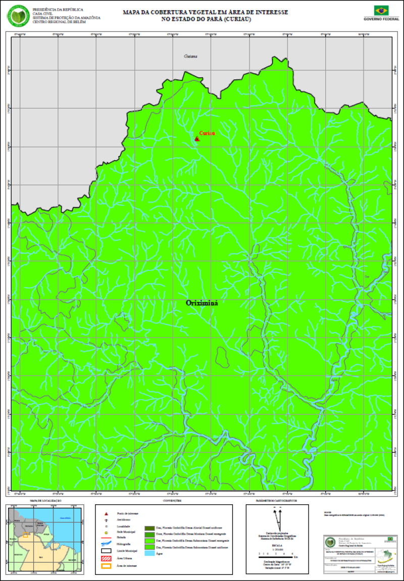
MAPA DA COBERTURA VEGETAL EM ÁREA DE INTERESSE NO ESTADO DO PARÁ (CURIAÚ)
MAPA DA COBERTURA VEGETAL EM ÁREA DE INTERESSE NO ESTADO DO PARÁ (CURIAÚ), elaborada a partir de Base cartográfica do SIPAM/IBGE em escala original 1:250.000 (2004). Com informações de Ponto de interesse, Aeródromo, Localidade, Sede Municipal, Estrada,Hidrografia, Limite Municipal, Área Urbana, Área de interesse e Cobertura Vegetal.
Citation proposal
. MAPA DA COBERTURA VEGETAL EM ÁREA DE INTERESSE NO ESTADO DO PARÁ (CURIAÚ). https://panorama.sipam.gov.br/geonetwork/srv/api/records/0cf1a18f-3ab9-4691-8507-84fefd392cd9
- Identification
- Distribution
- Quality
- Spatial rep.
- Ref. system
- Content
- Portrayal
- Metadata
- Md. constraints
- Md. maintenance
- Schema info
Identification
Data identification
Citation
- Date ( criation )
- 2009-03-24T15:18:00
- Presentation form
- Digital document
- Status
- Completed
Distributor
Avenida Júlio César, 7060 - Val-de-cans
Belém
Pará
66.617-420
Brasil
- Maintenance and update frequency
- As needed
- Keywords ( Theme )
-
-
Mapa da Cobertura Vegetal
-
- Keywords ( Place )
-
-
Curiau
-
Resource constraints
Legal constraints
- Access constraints
- Other restrictions
- Use constraints
- Other restrictions
- Classification
- Unclassified
- Spatial representation type
- Grid
- Denominator
- 250000
- Metadata language
-
por
- Character set
- UTF8
- Topic category
-
- Imagery base maps earth cover
- Boundaries
- Environment
))
Distribution
- OnLine resource
-
curiau_veg.pdf
(
WWW:DOWNLOAD-1.0-http--download
)Mapa da Cobertura Vegetal Curiau PA ( Tamanho 655 KB - PDF)
Quality
Data quality
- Hierarchy level
- Dataset
- Statement
-
FONTE: Base cartográfica do SIPAM/IBGE em escala original 1:250.000 (2004).
Ref. system
- Reference system identifier
-
WGS 84
Metadata
Metadata
- File identifier
- 0cf1a18f-3ab9-4691-8507-84fefd392cd9 XML
- Metadata language
-
por
- Character set
- UTF8
- Date stamp
- 2025-04-02T14:22:01
- Metadata standard name
-
Perfil de Metadados Geospaciais do Brasil
- Metadata standard version
-
Novembro/2009
Author
Sistema de Proteção da Amazônia - Centro Regional de Belém - Divisão de Sistematização de Informações
-Rosenilda Ferreira de Freitas
(Bolsista
)Avenida Júlio César, 7060 - Val-de-cans
Belém
Pará
66.617-420
Brasil
Md. constraints
Metadata constraints
Legal constraints
- Access constraints
- Other restrictions
- Use constraints
- Other restrictions
- Classification
- Unclassified
Overviews
Provided by
