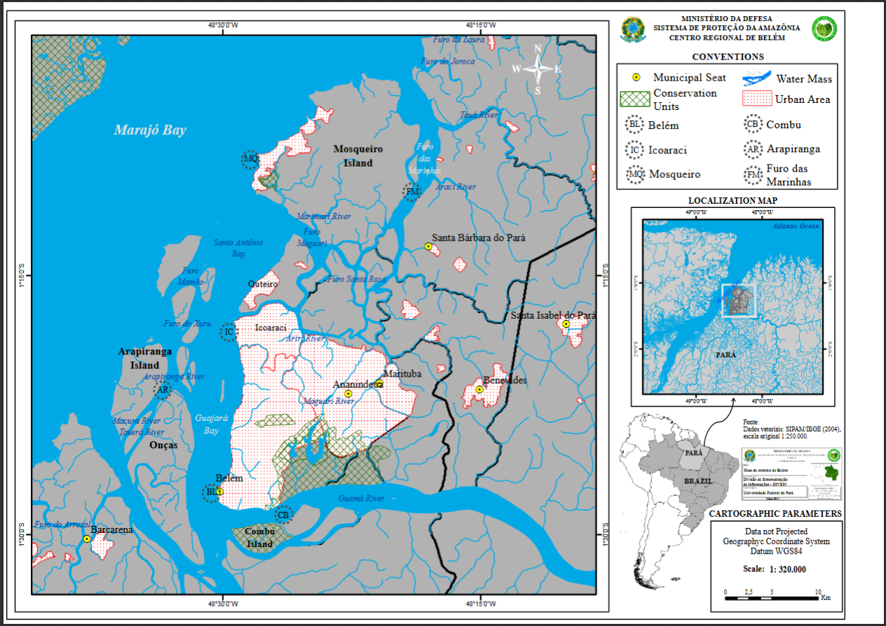
MAPA PLANIMÉTRICO DO MUNICÍPIO DE BELÉM E SUAS ILHAS - ESTADO DO PARÁ
Mapa planimétrico de Belém e suas Ilhas. Elaborado a partir da base vetorial SIPAM/IBGE (2004) dos seguintes temas: hidrografia, limite municipal, sedes e Unidades de Conservação, na escala original de 1:250.000. Apresentado os locais de coleta, conforme enviado pelo solicitante.
Citation proposal
. MAPA PLANIMÉTRICO DO MUNICÍPIO DE BELÉM E SUAS ILHAS - ESTADO DO PARÁ. https://panorama.sipam.gov.br/geonetwork/srv/api/records/6d9c47b6-9f7a-43a1-b397-11c0ca8464a6
INSPIRE
Identification
- File identifier
- 6d9c47b6-9f7a-43a1-b397-11c0ca8464a6 XML
Online resource
- Protocol
-
WWW:DOWNLOAD-1.0-http--download
- Protocol
-
WWW:DOWNLOAD-1.0-http--download
Resource identifier
- Metadata language
-
por
- Spatial representation type
- Vector
Encoding
Projection
- code
-
WGS-84
Classification of data and services
Classification of data and services
Coupled resource
Coupled resource
Classification of data and services
Coupled resource
Coupled resource
Keywords
Other keywords
- Keywords
-
-
Mapa Planimetrico
-
Geographic coverage
N
S
E
W
))
Temporal reference
Temporal extent
Temporal extent
- Date ( criation )
- 2011-03-26T15:37:00
Quality and validity
- Lineage
-
Fonte:
Dados vetoriais: SIPAM/IBGE (2004), escala original 1:250.000.
- Denominator
- 320000
Conformity
Conformity
Conformity
Conformity
Conformity
Conformity
Restrictions on access and use
Restrictions on access and use
Responsible organization (s)
Contact for the resource
- Organisation name
-
Sistema de Proteção da Amazônia - Centro Regional de Belém - Divisão de Sistematização de Informações
Responsible organization (s)
Contact for the resource
- Organisation name
-
Sistema de Proteção da Amazônia - Centro Regional de Belém - Divisão de Sistematização de Informações
Metadata information
Contact for the metadata
- Organisation name
-
Sistema de Proteção da Amazônia - Centro Regional de Belém - Divisão de Sistematização de Informações
- Date stamp
- 2020-04-09T14:02:11
- Metadata language
-
por
- Character set
- UTF8
SDS
Conformance class 1: invocable
Access Point URL
Endpoint URL
Technical specification
Conformance class 2: interoperable
Coordinate reference system
Quality of Service
Access constraints
Limitation
Use constraints
Limitation
Responsible custodian
Contact for the resource
Conformance class 3: harmonized
Overviews
Mapa_planimetrico_do_municipio_de_Belem_e_suas_Ilhas.PNG
Provided by

Views
Access to the portal
Read here the full details and access to the data.
Associated resources
Not available