SIPAMCidade: Santa Isabel do Rio Negro - AM
O SIPAMCidade é um programa do CENSIPAM que busca integrar as iniciativas desenvolvidas por cada um dos seus Centros Regionais com o objetivo de fornecer às prefeituras municipais da Amazônia Legal um instrumento de apoio ao planejamento municipal, facilitando a tomada de decisões, com vistas ao progresso socioeconômico e ambiental dos municípios, e a conseqüente melhoria na qualidade de vida de suas populações.
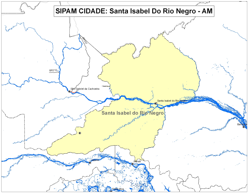
Consiste no fornecimento de um CD com a base cartográfica vetorial do município e imagens do satélite Landsat TM.
Data do trabalho: 2008
Citation proposal
(2011) . SIPAMCidade: Santa Isabel do Rio Negro - AM. https://panorama.sipam.gov.br/geonetwork/srv/api/records/73c97b71-4a49-4dc2-a1e3-e4532fba9ee9
INSPIRE
Identification
- File identifier
- 73c97b71-4a49-4dc2-a1e3-e4532fba9ee9 XML
Online resource
- Protocol
-
WWW:DOWNLOAD-1.0-http--download
- Protocol
-
WWW:DOWNLOAD-1.0-http--download
Resource identifier
- Metadata language
-
por
Encoding
Projection
- code
-
SAD69
Classification of data and services
Classification of data and services
Coupled resource
Coupled resource
Classification of data and services
Coupled resource
Coupled resource
Keywords
Other keywords
Geographic coverage
))
Temporal reference
Temporal extent
Temporal extent
- Date ( Publication )
- 2011-04-30T00:00:00
Quality and validity
- Lineage
-
Aeródromos 1:250.000 CCSIVAM/IBGE/SIPAM
Caminhos 1:250.000 CCSIVAM/IBGE/SIPAM
Desmatamento 1:250.000 INPE
Falhas Geológicas 1:250.000 CCSIVAM/IBGE/SIPAM
Focos de Calor 1:250.000 INPE
Geologia 1:250.000 CCSIVAM/IBGE/SIPAM
Geomorfologia 1:250.000 CCSIVAM/IBGE/SIPAM
Grade CBERS 1:250.000 CCSIVAM/IBGE/SIPAM
Grade Landsat 1:250.000 CCSIVAM/IBGE/SIPAM
Hidrografia 1:250.000 IBGE/SIPAM
Ilhas 1:250.000 CCSIVAM/IBGE/SIPAM
Limite Municipal 1:500.000 IBGE
Localidades 1:250.000 CCSIVAM/IBGE/SIPAM
Rodovias 1:250.000 CCSIVAM/IBGE/SIPAM
Sede Municipal 1:250.000 CCSIVAM/IBGE/SIPAM
Solos 1:250.000 CCSIVAM/IBGE/SIPAM
Terras Indígenas 1:250.000 IBGE/SDS-AM
Títulos Minerários 1:100.000 INPE
Uso do Solo 1:250.000 CCSIVAM/IBGE/SIPAM
Vegetação 1:250.000 CCSIVAM/IBGE/SIPAM
Sensor: TM LANDSAT Resolução Espacial: 30 metros. Composição RGB: 5-4-3.
Ano 2008.
- Denominator
- 250000
Conformity
Conformity
Conformity
Conformity
Conformity
Conformity
Restrictions on access and use
Restrictions on access and use
Responsible organization (s)
Contact for the resource
- Organisation name
-
Sistema de Proteção da Amazônia - Centro Regional de Manaus - Divisão de Sistematização de Informações
Responsible organization (s)
Contact for the resource
- Organisation name
-
Sistema de Proteção da Amazônia - Centro Regional de Manaus - Divisão de Sistematização de Informações
Metadata information
Contact for the metadata
- Organisation name
-
Sistema de Proteção da Amazônia - Centro Regional de Manaus - Divisão de Sistematização de Informações
- Date stamp
- 2025-04-02T14:23:52
- Metadata language
-
por
- Character set
- UTF8
SDS
Conformance class 1: invocable
Access Point URL
Endpoint URL
Technical specification
Conformance class 2: interoperable
Coordinate reference system
Quality of Service
Access constraints
Limitation
Use constraints
Limitation
Responsible custodian
Contact for the resource
Conformance class 3: harmonized
Overviews
Provided by
