MAPA PLANIMÉTRICO DO ESTADO DO AMAPÁ
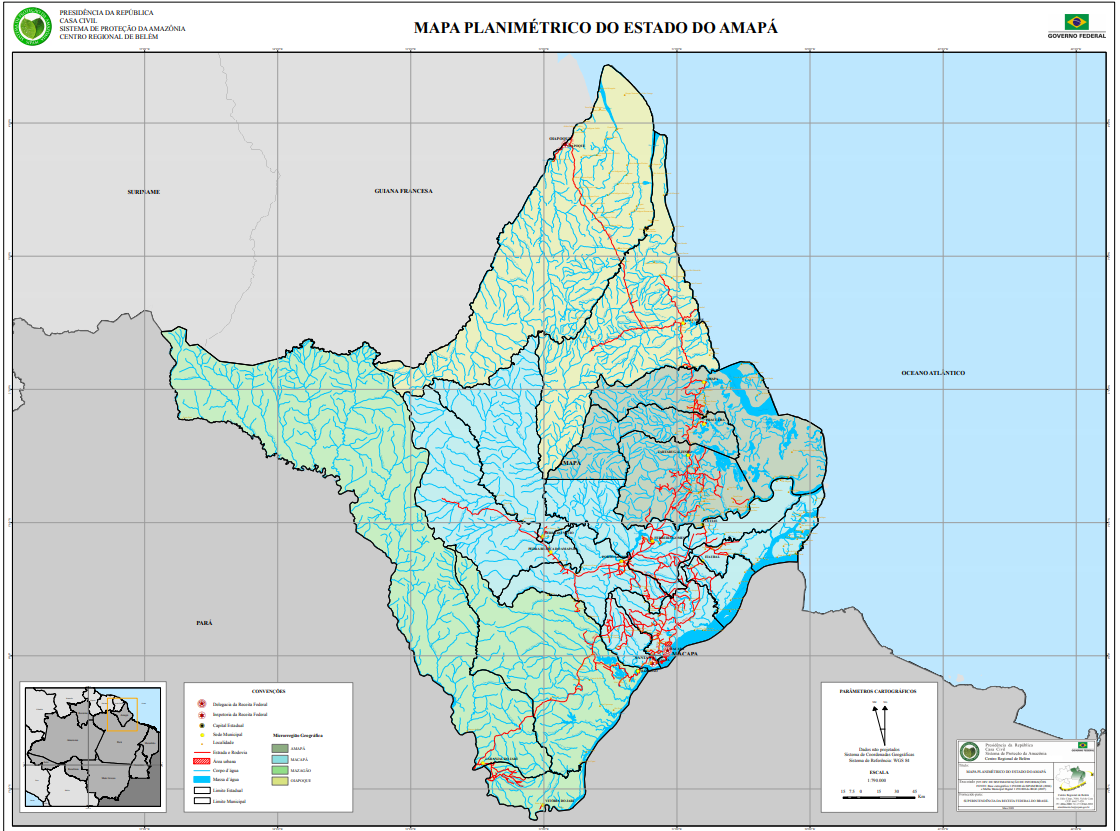
Mapa Planimétrico do Estado do Amapá com base cartográfica em escala de 1: 790.000 com informações de área urbana, corpo d'agua, massa d'agua, microrregião geográfica.
Citation proposal
. MAPA PLANIMÉTRICO DO ESTADO DO AMAPÁ. https://panorama.sipam.gov.br/geonetwork/srv/api/records/c44cce2c-fba0-4869-9898-6a0a10704e4b
INSPIRE
Identification
- File identifier
- c44cce2c-fba0-4869-9898-6a0a10704e4b XML
Online resource
- Protocol
-
WWW:DOWNLOAD-1.0-http--download
Resource identifier
- Metadata language
-
por
Encoding
Projection
- code
-
WGS 1984
Classification of data and services
- Topic category
-
- Imagery base maps earth cover
Classification of data and services
Coupled resource
Coupled resource
Classification of data and services
Coupled resource
Coupled resource
Keywords
Other keywords
- Keywords ( Theme )
-
-
Planimetria
-
- Keywords ( Place )
-
-
Amapa
-
Geographic coverage
N
S
E
W
))
Temporal reference
Temporal extent
Temporal extent
- Date ( criation )
- 2009-04-22T17:48:00
Quality and validity
- Lineage
-
Mapa Planimétrico do Estado do Amapá com base cartográfica de 1:250.000 do SIPAM/ IBGE (2004) e Malha Municipal Digital de 1:250.000 do IBGE (2007).
- Denominator
- 790
Conformity
Conformity
Conformity
Conformity
Conformity
Conformity
Restrictions on access and use
Restrictions on access and use
Responsible organization (s)
Contact for the resource
- Organisation name
-
Sistema de Proteção da Amazônia - Centro Regional de Belém - Divisão de Sistematização de Informações
Responsible organization (s)
Contact for the resource
- Organisation name
-
Sistema de Proteção da Amazônia - Centro Regional de Belém - Divisão de Sistematização de Informações
Metadata information
Contact for the metadata
- Organisation name
-
Sistema de Proteção da Amazônia - Centro Regional de Belém - Divisão de Sistematização de Informações
- Date stamp
- 2020-09-29T12:00:09
- Metadata language
-
por
- Character set
- UTF8
SDS
Conformance class 1: invocable
Access Point URL
Endpoint URL
Technical specification
Conformance class 2: interoperable
Coordinate reference system
Quality of Service
Access constraints
Limitation
Use constraints
Limitation
Responsible custodian
Contact for the resource
Conformance class 3: harmonized
Overviews
Imagem_amapa.PNG
Provided by

Views
Access to the portal
Read here the full details and access to the data.
Associated resources
Not available